Tours into the frontier: (Rough and Remote Madagascar Tours)


The image shows a map of Madagascar with several cities marked with blue pins and a possible route highlighted in yellow.

40 天自行车骑行之旅,穿越马达加斯加全境(路线 1 - 偏远的野生奇观)

为期 2 个月的自行车之旅,有支持和豪华露营,穿越岛上游客最少的地区,从头到脚游览其最佳景点。

A map of Madagascar with blue location pins marking cities and areas, showing a possible route around the island.

为期 40 天的支持性自行车旅行,穿越马达加斯加全境(路线 2 - 中央文化轴)

2 个月的旅行穿越全岛所有主要的文化城市和景点 - 路线选项 2。

This map shows the northeastern part of Madagascar, featuring towns like Antsiranana (Diego Suarez), Sambava, and Vohimarina, along with the Tsaratanana Nature Reserve. Blue pins mark specific locations across the region.

Madagascar Real Frontier Tour (The toughest trip on the island) - Overlanding by Off-Road Car from Nosy Be South to Maroansetra and Masoala

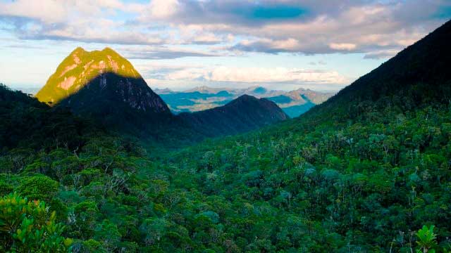
Very rough and real serious exploratory adventure trip from Nosy Be south, where no tourists go and where there is little to zero infrastructure. The road less (or never) traveled. This is the single hardest trip you can do in the country, and the most remote area with the people least-visited by tourists from the outside.

This is a map of Madagascar, showing the main cities and roads.  Blue pins are placed along the eastern coast, potentially marking points of interest.  The western side shows a less populated area.

Madagascar Real Frontier Tour: Overlanding by Off-Road Car and Canal Boat from Tamatave South to Farafangana and Manakara

Very rough and real serious exploratory adventure trip from Tamatave south, where no tourists go and where there is little to zero infrastructure. The road less (or never) traveled.

A map of the northeastern coast of Madagascar, showing the location of several towns and villages marked with blue pins.

Madagascar Real Frontier Tour: Overlanding by Off-Road Car from Tamatave North to Maroansetra and Masoala

Very rough and real serious exploratory adventure trip from Tamatave north, where no tourists go and where there is little to zero infrastructure. The road less (or never) traveled.

The image depicts a map of Madagascar with various location markers, possibly indicating a travel route. The markers include lodging icons, blue location pins, and symbols for cycling and swimming. Prominent cities labeled are Antananarivo, Mahajanga, and Toliara.

穿越马达加斯加的 50 天超级马拉松(骑自行车、划皮艇和徒步旅行全岛)

为期 2 个月的旅行,将骑自行车、丛林徒步旅行、徒步旅行、海上皮划艇和公路自行车旅行结合在一起,从上到下骑遍整个马达加斯加。

Tours into the frontier: (Rough and Remote Madagascar Tours) Map

Madagascar - Travel and Tours