
40 päivän tuettu pyöräretki koko Madagaskarin ylhäältä alas (reitti 1 - Remote Wild Wonders)
Kahden kuukauden vakava pyöräilyretki, tuettu ja telttailu saaren vähiten vierailluilla osilla, kärjestä varpaisiin, sen parhaiden paikkojen halki.

40 päivän tuettu pyöräretki koko Madagaskarin ylhäältä alas (reitti 2 - Keskikulttuuriakseli)
2 kuukauden matka koko saaren läpi tärkeimmissä kulttuurikaupungeissa ja -kohteissa – reittivaihtoehto 2.
 – Overlanding by Off-Road Car from Nosy Be South to Maroansetra and Masoala")
Madagascar Real Frontier Tour (The toughest trip on the island) - Overlanding by Off-Road Car from Nosy Be South to Maroansetra and Masoala
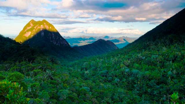
Very rough and real serious exploratory adventure trip from Nosy Be south, where no tourists go and where there is little to zero infrastructure. The road less (or never) traveled. This is the single hardest trip you can do in the country, and the most remote area with the people least-visited by tourists from the outside.

Todella karkea etäretki Madagaskarille etelään: Tamatavesta Farafanganaan autolla ja kanavalla
Erittäin karkea ja todella vakava tutkiva seikkailumatka Tamataven etelästä, jossa ei käy turisteja ja jossa infrastruktuuria on vähän. Tie on vähemmän (tai ei koskaan) kuljettu.

Madagascar Real Frontier Tour: Overlanding by Off-Road Car from Tamatave North to Maroansetra and Masoala
Very rough and real serious exploratory adventure trip from Tamatave north, where no tourists go and where there is little to zero infrastructure. The road less (or never) traveled.

Madathon Marathon: Kayak Hike and Bike Through all of Madagascar Overland
2 month trip combining cycling, jungle hiking, trekking, sea kayaking, and road cycling all of Madagascar from top to bottom, in style