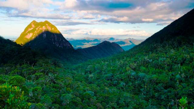


马达加斯加偏远地区南行之旅:乘坐汽车和运河从塔马塔夫前往法拉方阿纳
从塔马塔夫(Tamatave)向南出发,这是一次非常粗略、真正严肃的探险之旅,游客都不去那里,那里的基础设施几乎为零。这是一条人迹罕至(或从未走过)的路。

马达加斯加偏远地区北行之旅:乘坐越野车从塔马塔夫前往马罗安特拉/马苏阿拉
从塔马塔夫(Tamatave)以北出发的探险之旅非常粗糙,是一次真正严肃的探险之旅,那里没有游客,基础设施几乎为零。这是一条人迹罕至(或从未走过)的路。
EXPEDITIONS @ EARTH’S MOST UNIQUE ISLAND
从塔马塔夫(Tamatave)向南出发,这是一次非常粗略、真正严肃的探险之旅,游客都不去那里,那里的基础设施几乎为零。这是一条人迹罕至(或从未走过)的路。
从塔马塔夫(Tamatave)以北出发的探险之旅非常粗糙,是一次真正严肃的探险之旅,那里没有游客,基础设施几乎为零。这是一条人迹罕至(或从未走过)的路。