

Gerçekten Zorlu Uzak Madagaskar Turu Güney Yönü: Araba ve Kanalla Tamatave'den Farafangana'ya
Tamatave'nin güneyinden, hiçbir turistin gitmediği ve çok az veya sıfır altyapının olduğu çok zorlu ve gerçek ciddi keşif macera gezisi. Daha az (veya hiç) gidilmeyen yol.

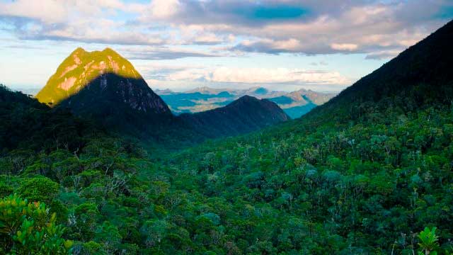
Madagascar Real Frontier Tour: Overlanding by Off-Road Car from Tamatave North to Maroansetra and Masoala
Very rough and real serious exploratory adventure trip from Tamatave north, where no tourists go and where there is little to zero infrastructure. The road less (or never) traveled.